Regional Geography
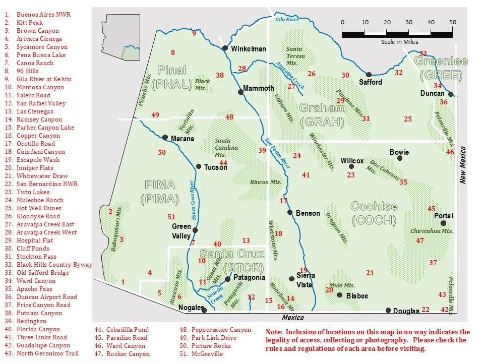
As the map indicates, SE Arizona includes all parts of Arizona south of the Gila River and east of the Baboquivari Mountains, perhaps 15% of the state. This includes all of Cochise and Santa Cruz counties, major parts of Graham, Pima, and Pinal counties and the southern tip of Greenlee County. Several publications (i.e., Bailowitz and Brock 1991, Bailowitz and Brock 2022, Heald 1993, Warshall 1995) have focused on this region's natural history and its strong connection to the Mexican Sierra Madre Occidental and surrounding desert biomes. It is truly a small piece of western Mexico closeted within the bounds of the United States and with an entomological lushness that is nearly unrivaled in this country. Part of this richness is attributable to the Rocky Mountain elements penetrating the region from the north, most easily seen in the Pinaleño Mountains, the tallest of Arizona’s Sky Islands, between Willcox and Safford. The lowest deserts introduce arid terrain penetrating from the west into the northwestern corner of our region, bringing with it an array of low desert species. This can readily be seen along Park Link Drive connecting Interstate 10 and State Route 79, near Picacho Peak between Casa Grande and Tucson, and in the 96 Hills in Pinal County between Phoenix and Tucson. Finally, the Chihuahuan Desert pushes against the Peloncillo Mountains east of Rodeo, largely on their eastern flank, bringing eastern species from the Mexican Plateau into the mix. Examples here include Ward Canyon north of San Simon, the hill country west of Duncan, and the Black Hills Back-Country Byway (between Safford and Clifton). Thus, as with other locally rich groups, bee flies' diversity reflects inputs from a number of regions that converge within the crosshairs at SE Arizona, uniting them all and creating this vast array of species.